“A man who conquers himself is greater than one who conquers a thousand men in battle”. – Buddha
Today we drove down to Jim Thorpe to explore part of the Lehigh Gorge State Park. The Lehigh Gorge Trail follows 26 miles of a former railroad line along the Lehigh River, providing opportunities for hiking, biking and sightseeing. Our first stop was at the Rockport Access to the gorge. We hiked along the rail trail to see Buttermilk Falls and Luke's Falls. I think we'd like to come back next summer with our bikes, so we could explore more of the trail. It would also be fun to do a rafting trip down the Lehigh River.
Part of the Lehigh Gorge Trail.
Buttermilk Falls
The Lehigh Gorge Trail is part of the longer D&L Trail that is 165 miles long, running from Wilkes Barre to Bristol.
Luke's Falls
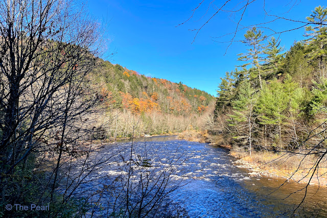
The Lehigh River
Buck Mountain Creek is just one of many creeks that flows into the Lehigh River.
Our next stop was the cute little town of Jim Thorpe. We spent an afternoon here in June, but didn't get to do any hiking in the area. After a nice lunch and a little shopping we hiked to the summit of Mount Pisgah. The Mount Pisgah Trail follows the Switchback Railroad, built in the early 1800s to carry coal from mines in the mountains to the Lehigh Canal below. The trail to the summit was steep, rocky and roughly 0.7 miles long, with 500' of elevation gain along the way. It was truly a workout.
History Lesson:
The Switchback Gravity Railroad, built in 1827, was only the second railroad built in America. It ran nine miles, hauling coal from Summit Hill down to the town of Mauch Chunk (Jim Thorpe) and the Lehigh Canal. As the name implies, it relied on gravity to come down the mountain, with mules hauling the empty cars back up.
By 1844, the line's success and subsequent traffic necessitated a separate “backtrack” for empties. This created an 18-mile, figure-8 track plan, with the empties pushed up two steep grades by a steam-powered contraption that emerged from beneath the rails.
During non-peak hours, the railroad offered rides along the route for the public, in specially outfitted cars. Following the line's dramatic descents and loops, these cars could attain speeds of up to 50 miles per hour. In the 1870s the route was devoted exclusively to hauling passengers and became one of the nation's first tourist railroads. Only Niagara Falls exceeded the site's 75,000 annual visitors. This wild ride—in which carloads of passengers plunged at high speeds from steep peaks—served as the model for the first roller coaster, introduced on Coney Island in 1884.
This picture can't convey how steep this trail actually was...but the trees look beautiful.
The trail
The Summit
Looking down on the Lehigh River and the Lehigh Gorge Scenic Railway. The following pictures were taken from there.
Looking up to the summit of Mount Pisgah.
The Lehigh Gorge Scenic Railway train.
Turn Hole Tunnel at Lehigh Gorge State Park. Turn Hole Tunnel is an abandoned railroad tunnel located near the Glen Onoko access to Lehigh Gorge State Park. It was constructed in 1866 and is 496 feet long. Unfortunately there were posted signs saying we couldn't go inside.
The leaves are quickly disappearing, but the ones that are still here are amazing.


No comments:
Post a Comment