“Great things never came from comfort zones.” ―Anonymous
One of the most beautiful areas in the Pocono Mountains is the Delaware Water Gap, where 40 miles of the Delaware River run between high bluffs and forested shores. It has beckoned visitors to the Pocono Mountains for centuries and is known as the Gateway to the Poconos. The Delaware Water Gap National Recreation Area is a wonderful place to canoe, kayak, camp, fish and hike. It's full of beautiful waterfalls and stunning vistas to enjoy. The DWG is situated within the most densely populated region of the United States and provides a unique opportunity to experience tranquil landscapes. Interstate 80 runs through the gap and has to be the most beautiful view from any highway I've seen.
A water gap is formed when water carves its way through a mountain range. The Delaware Water Gap is known for its depth, width, and scenic beauty. It's more than 1,200 feet from mountaintop to the river surface, nearly a quarter mile wide at river level and about a mile wide from the top of Mt. Tammany to the top of Mt. Minsi. Our first hike in the DWG was along part of the Appalachian Trail that took us to the top of Mount Minsi. The four mile hike gave us dramatic views of the Delaware Water Gap and Mount Tammany and wound through rhododendron tunnels and past a few small waterfalls. It was a bit chilly when we started the hike, but it felt exhilarating to be in such a beautiful place on such a beautiful day.
The first part of the trail was very easy and relaxing...a stroll in the woods.
Part of the rhododendron forest we went through. It must be beautiful here in July when they bloom.
We took a break at Lookout Rock...what an incredible view.
From the lookout we had a great view of I80. We knew the kids would be coming by soon on their way to NYC, so we waited to see them go by.
That's their car circled in red. It's also in view in the above photo...just harder to make out.
More pictures of the trail.
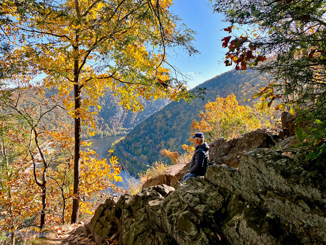
The second great lookout over the Delaware Water Gap.
Part of the trail up to Mount Minsi. It gave us a good workout.
Looking at Mount Tammany from the top of Mount Minsi.
We are loving the beautiful color...but they will soon be gone.
The Appalachian Trail goes through fourteen states along the crests and valleys of the Appalachian Mountain Range. It starts in Georgia and ends in Maine. The trail is marked by white "blazes", which are most often found on trees. The trail is almost 2200 miles long. This small portion of the trail was beautiful.
Looking up to Mount Minsi from the scenic drive that goes along the Delaware River. (RT611)
Looking towards Mount Tammany from the overlook on the RT611.


No comments:
Post a Comment